|
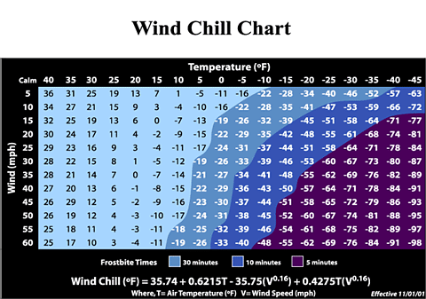
Effective this November 1st, the National Weather Service will implement a new wind chill formula found on the following basis (compared to the previous index now in place):
1. Use calculated wind speed at an average height of five feet (typical height of an adult human face) based on readings from the national standard height of 33 feet (typical height of an anemometer)
2. Be based on a human face model.
3. Incorporate modern heat transfer theory, I.E, heat loss from the body to its surroundings during cold and breezy or windy days.
4. Lower the calm wind threshold from 4 mph to 3 mph.
5. Use a consistent standard for skin tissue resistance.
6. Finally, assume no impact from the sun.
The new wind chill will hopefully better give us an understanding of what the temperature feels like when you throw wind into the mix.
The new formula, if you are a math whiz and would like to try it out is...
35.74 + 0.6215T - 35.75 (V0.16) + 0.4275T (V0.16) with T = air temperature in degrees fahrenheit and V = wind speed (velocity) in miles per hour (MPH).
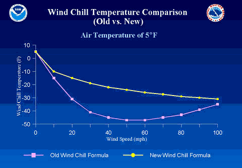
Refer to the graphics below for more information on the apparent temperature index.
|
|